Daily Buzz | MassDot Explains Route 3A Project Plan
And Recreation Department winter registration open
Good Morning, Neighbor!
I hope you had a good week and are looking forward to the weekend. I neglected to remind you about Recreation Department registration (because I myself forgot) yesterday, but it is open! The Town website was down for a bit last night, but the registration worked—if you had the right link.
Please don’t forget to upgrade to a paid membership during the month of November and support People Helping People!
Route 3A Project Information Meeting
I was able to attend the informational meeting about the Route 3A project (while multitasking); here are my notes. Lots of them are verbatim what the presenter said, because the presentation moved very quickly and there wasn’t a lot of room for editorializing.
The goals of the project are to:
Maintain a state of good repair
Improve lane safety
Improve accessibility for pedestrians
Meet MassDOT’s Complete Streets Regulations
(It was said several times throughout that this is a maintenance project) and the goals did not include making improvements to traffic.)
We will get there by:
Resurfacing the roadway
Improving bus stops and pedestrian facilities
Reducing the lane width to a standard size
Introducing a bike lane
Options that were considered:
Resurface and preserve existing lanes (but there would be no enhancements or safety improvements, and Route 3A would still not be completely accessible to bicyclists or pedestrians)
Resurface and propose buffered bike lanes, making lanes 11 feet wide (this satisfies every goal and made lanes a consistent width that complies with federal and state standards, and also makes expectations clearer to users of the road)
Resurface and propose two-way left turn lane (but this doesn’t provide multi-modal equity, meaning it would still not be accessible and equitable for bicyclists)
MassDOT recognizes it feels like narrowing a 4-lane to a 2-lane, but really it was never meant for cars to travel side by side. They showed some examples from Hingham, Wellesley, Nonantum Road, and William J Day Blvd where the safety of the roadways was improved and travel times were not excessively impacted by going from an actual 4-lane to a 2-way road.
Critical design at each intersection:
At the Cook Street intersection, lane striping will be preserved but a bike box will be added to make it safer for cyclists to turn.
At Pinehurst, there’s enough width to preserve current approach and lane configurations AND add a bike lane.
Francis Wyman Road also had enough width to preserve current approach lanes and add a designated bike lane and a bike box for cyclists taking a left from 3A to Francis Wyman Road.
Wilmington Road: there’s no additional width to add a bike lane. Bikes will have to choose to ride on sidewalk (not recommended and technically illegal) or with traffic (may the odds be ever in your favor), but the bike lanes will resume just before and after the intersection.
From Skilton Lane to Bedford Street, two vehicle lanes in each direction are necessary and no bike lanes will be added under this project (they can only work with curb-to-curb width, and adding a bike lane would require space they don’t have). This will remain similar to what is there today.
Terry Ave. and Winn Street - they’ll redefine shoulders and provide lane markings, but otherwise the current lanes will be preserved. This has high accidents statewide, and they’ll be adding some safety features to the signals.
At Bedford Street, the approaches will look similar to today, and then the bike lane will pick back up south of this intersection.
Accessibility:
Accessible sidewalks and curb ramps where necessary, to provide consistent accessibility.
Crosswalks will be improved with recessed lighting and more.
The presenter described Burlington as a “low comfort, high stress biking environment,” which, *can confirm*. These improvements seek to decrease the high stress and maybe increase the comfort a tad.
Bus stops will also be improved and some relocated closer to crosswalks; 2 MBTA stops will be eliminated, but they’re close to other stops and have low ridership.
Travel time is expected to be pretty much unaffected (an increase from 6-7 minutes, for example).
This is intended to be a phased construction project over two years. No detour routes are expected - only short-term closures.
They anticipate advertising the project in February and beginning it in late spring.
Contact info for questions or feedback:
Carrie Lavallee, PE, Chief Engineer
MASSDOT Highway Division
01 Park Plaza
Boston MA 02115
Attention: Project Management, PROJECT FILE NO. 610704
massdotprojectmanagement@dot.state.ma.us
Questions/concerns that came up:
Traffic study was done during COVID. Can you do a new traffic study? They had taken a lot of data before the pandemic and used as much of that 2019 data as they could for baseline numbers, adding an exponential increase for natural population increase.
Why are the bike lanes not going through the whole project? The lanes aren’t wide enough, and adding a bike lane in those areas would take a lane of traffic away, since as a maintenance project the state isn’t in a position to widen the lanes (also that would mean easements and other legal words).
How big is the demand for bike lanes? The real answer to this question is that current bike use isn’t a valid way to measure demand since the roadway is not currently safe for bikes. Their goal during this process is to make this a safe corridor. They need to standardize the lanes in order to make the corridor safe. This leaves enough room for one travel lane and one bike lane in those places where bike lanes will be installed.
Why were these specific boundaries set? Why not further north or south? Budget and the current state of repair of the road gave them this section to prioritize.
There were more questions and comments (like, a lot of them); please forgive me for not transcribing them all. This captures the gist of the discussion, though.
Today in Burlington
Nothing official on the calendar, but plenty of events for diversion and connection.
Meetings and Events
- Story and craft at the library. Toddlers (18-36mo) at 10:30 and preschool age (3-6y) at 11:30.
- 4:00 PM - Turkey cookie making event at the library for grades 6-12.
- 7:00 PM - Burlington Womenade Ladies’ Night Out and Pot Luck to support the family of Maureen Schnee, a mom of two and Burlington Teacher who is recovering from a heart transplant. Participate or donate by clicking the Facebook Event link above or going to the Burlington MA Womenade website.
- 7:30 PM - North Shore Rock and Mineral Club Annual Auction at the Senior Center. This event is open to the public!
Friday Funny
I was at a math conference yesterday, and this slide opened the keynote. Took me a minute.
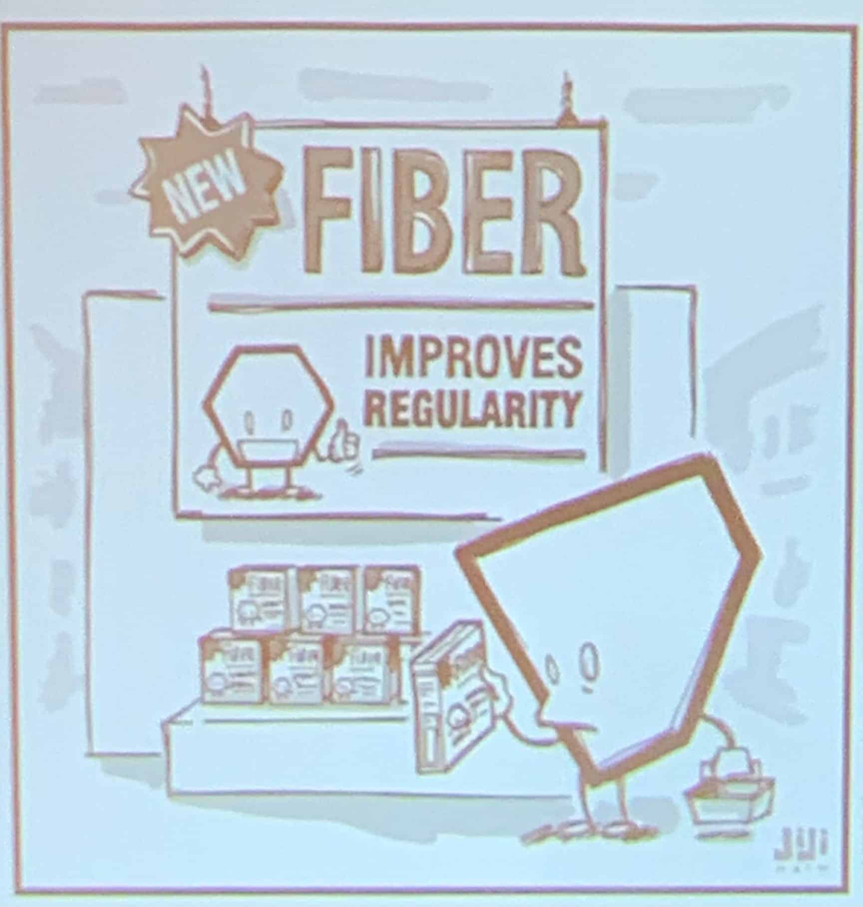
That’s all I have for today. Enjoy your Friday!
Nicci
